SAMWISE project
This project is part of an ongoing trans-Tasman collaboration between scientists from the Australian National University, Te Herenga Waka/Victoria University of Wellington and Earth Science New Zealand (formerly GNS Science).
Our team plans to install nine seismometers and four weather stations east of Aoraki/Mount Cook in the central Kā Tiritiri o te Moana/Southern Alps. This effort is part of the Southern Alps Monitoring of Weather-Influenced Seismicity and Erosion project (SAMWISE FDSN page).
Installation is scheduled to begin between October and November 2025 and will last for two years.
The SAMWISE seismic network is designed to complement existing local seismometers (see aquamarine triangles on the map below) and enhance our ability to passively record small-magnitude, naturally occurring earthquakes and other environmental signals (e.g., landslides, avalanches, rockfalls) in one of the world’s most active orogens.
Data and metadata from this project will be made publicly available (e.g., via AusPass) in accordance with ANSIR’s FAIR data policy within two years of project completion.
Map of planned deployment
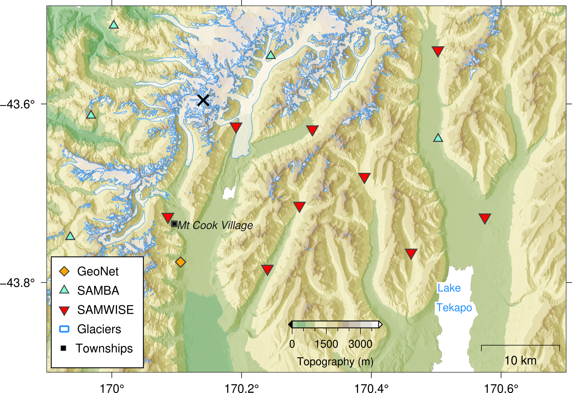
Red triangles show the SAMWISE seismometer sites. Aquamarine triangles and the orange diamond depict the existing SAMBA and GeoNet stations. The black cross indicates Aoraki/Mount Cook summit.
This project is funded by the Australian Government (NCRIS) through the AuScope Program. Instruments are loaned from ANSIR: a partnership of universities and public agencies in Australia and New Zealand supporting geophysics research across Australasia. For more information about these programs, visit: ANSIR's website.